• Home
  • About
    • Who We are
    • Affiliates
    • Disclosures & Guidelines
    • FAQs
    • Privacy Notice
  • Funding Your Travels
    • Banking on the Road
    • Credit Cards in Our Wallet
    • Spending
  • Contact
    • Media
    • Submission Guidelines
    • Partnership Opportunities

i should log off

log off and live!

  • Travel & Planning
    • Travel Reflections
      • Good, Bad & Ugly
      • Re-Entry
    • Travel Resources
      • Travel Tips
      • Travel Bloggers
    • Reviews
      • Gear
      • Operators
      • Travel Clothing
    • Travel Gear
      • Cameras
      • Danny’s Clothes
      • Electronics
      • Health & Hygiene
      • Jillian’s Clothes
      • General Gear
  • Destinations
    • Travel Guides
    • Africa
      • Egypt
      • Ethiopia
      • Lesotho
      • Kenya
      • Malawi
      • Morocco
      • Mozambique
      • Namibia
      • South Africa
      • Sudan
      • Swaziland
      • Tanzania
      • Uganda
      • Zimbabwe
    • Asia & Oceania
      • Armenia
      • Cambodia
      • China
      • Georgia
      • India
      • Kazakhstan
      • Laos
      • Thailand
      • Turkey
      • Uzbekistan
      • Vietnam
    • Caribbean
      • Antigua
      • Cuba
      • Jamaica
    • Central America
      • Belize
      • Costa Rica
      • Guatemala
      • Honduras
      • Nicaragua
      • Panama
    • Europe
      • Armenia
      • Austria
      • Belgium
      • Czech Republic
      • France
      • Georgia
      • Germany
      • Hungary
      • Italy
      • Spain
      • Turkey
    • North America
      • Canada
      • Mexico
      • USA
    • Middle East
      • Egypt
      • Israel
      • Jordan
      • Oman
      • Turkey
    • South America
      • Argentina
      • Brazil
      • Bolivia
      • Chile
      • Colombia
      • Ecuador
      • Peru
      • Uruguay
  • Weekend Adventures
    • Cycle
      • Pastimes
        • Beer & Wine
        • Books
        • Cooking
        • History & Culture
    • Dive & Snorkel
    • Hike
    • Trek
    • Whitewater
  • Photos
    • Photo of the Day
  • Family Travel
You are here: Home / Archives for Weekend Warrior / Hike

Hiking Mt. Shasta

July 28, 2016 By Danny

After climbing Mt Kilimanjaro in 2010, I felt a strong sense of accomplishment but also that mountaineering was not for me.  More than anything else I hated the altitude but at lease with Kilimanjaro I didn’t have to do anything technical with ropes or ice axes.  Fast forward 6 years and somehow I found myself doing exactly what I never expected to even try on the slopes of California’s Mt. Shasta.  Two years ago I managed to join a group of intrepid colleagues on a hiking trip where I climbed Yosemite’s Half Dome.  The trek was fun, and with a start-to-summit time of about 4 hours, and a round-trip time of about 7 hours’ total, this was relatively simple and straight forward.  IMGP2439

Last year this same group did a 26-mile loop over four mountain passes around Colorado’s Maroon Bells.  This was simply the most difficult day of hiking I’d ever completed.  At the celebration dinner, following our 16-hour hike which had begun at 10pm the previous evening, Mt. Shasta’s (4321m) 14,179 foot snow-capped peak was announced as our next target.  Sure, I told everyone I’d see them next year…but I also said that there was no-way Donald Trump would be the republican nominee for president….  What do I know?

As this was a technical climb we hired guides to help us through the process.  To do that we had a short amount of time on some snow the day preceding the hike to learn some basic mountaineering skills such as how to actually use the ice axe. We learned to walk on the ice, fall and ultimately stop ourselves from sliding all the way down the mountain.  Naturally, we felt the need to practice this by running off the hill (while holding an axe) and diving downhill as though we were superman.  This was fun until one of our team cracked his ankle in a few places.  He was taken to the ER and received screws in his ankle and lots of painkillers.  As a reminder, this was our practice session.  Our group the prior year had started off around 35 people, for what was the hardest day of hiking in my life, we were now down to only 16.
One of the reasons for the low numbers were the odds the various guide services had given to our venture. 

Most guided groups climb Mt. Shasta over two days.  Indeed, while we were practicing, many of these groups were setting off on their trek.  They camped overnight half-way up the mountain, continuing to the summit with us the following morning.  We instead chose to skip the alpine camping and start our walk at midnight.  There were three guide companies in Mt. Shasta that were contacted by our group, two of those companies told us we were idiots for what we were trying to do, we went with the third. (Now you see why I like these people – like minded to the fullest!)

At 11pm on Saturday night, when most people in California were doing Saturday night California things, we were instead waking up from our naps, doing our best to clear our bowels, and gradually making our way to the  Avalanche Gulch trail head for our midnight departure. (Note: All the amazing and yet, WTF am I thinking hiking adventures in my life have seem to start at night.)  I had some general feelings of dread regarding my own fitness level, the altitude, the ice axe, the ice itself and naturally those screws that had been inserted into my friend’s ankle.  Also in the back of my head was concern for the weather report, which featured late morning thunderstorm, but when I saw the clear, starry sky at the trail head I managed to but those fears to rest.


We started walking. 


The guides kept the pace and I have to say, we had some excellent guides.  They made the walk up this [to me] practically vertical slope about as easy as walking up the stairs at work.  Sure it was long and arduous but many of us felt we were so well paced that, although exerting ourselves, we never felt terribly short of breath or in need of a rest.  Still, several did begin to fall behind but overall our group was on target and moving uphill at a very good pace.


With several hikers having difficulty as we passed the overnight camping areas, we had to shuffle groups around a little bit.  Part of the reason for this was that above this point, Helen Lake which is nothing but a flat-ish area of snow on the mountain, guides needed to be roped to their group and a single guide could have no more than 4 hikers attached to them.  Continuing on we were one group of 4 and three groups of 3, I was in a group of 3.

As we continued from this point, the story starts to change substantially.

All of the things I was worried about—the ice, using the axe, my fitness, etc.—were not issues at all and I was actually starting to enjoy myself as the sun came up and I recognized what a special place I was in.  The problem was that as the sun came up most of the other hikers on the mountain started to come down.  Those late morning thunderstorms had shown up several hours early and the mountain appeared to be surrounded by dark clouds and piercing lightning shows.  Via radio we were in touch with another group from our guiding company, who had camped on the mountain like *normal* climbers and were several thousand feet above us.  Their reports were not positive and they turned back as well.  For some reason we kept on hiking.


IMGP2448


One member of my trio was beginning to struggle and was very vocal about this in a stunningly constructive way, perhaps because he is a former Marine.  He shared that he was feeling the affects of altitude sickness, the items he was doing to help deal with his, and that he wanted to continue but that it was a situation we needed to keep in communication about.  This was important as none of us were unable to travel alone and if he needed to go down, we all did, so we slowed our speed an slightly increased the frequency of our breaks.  The support of the team in this regard was rather spectacular.

Later, using the Marine as something of a model, I expressed my same concerns with regard to the weather.  By this point we had become 4 hikers, rather than 3, as another trio had a member need to descend and one of their hikers was able to join us.  I told the group honestly that I was getting quite scared by the increasing display of lightning, the blizzard forming around us, the presence of the wind, etc.  Mostly though, it was the lightning combined with “my children need to have a daddy”.  Our guide, a former Army Ranger, discussed this with us and we took a vote in which two of us expressed that we felt it might be time to head downhill.  Somehow being led by an Army Ranger, who stated clearly that he had full confidence in his ability to get us safely down the mountain, and anchored by a US Marine who was feeling much better and aching to get to that summit, convinced myself and the other doubter that we should press on, so that’s what we did.

We got to the top of the red line, but not to the summit.
We got to the top of the red line, but not to the summit. 🙁

The hiking at this point was also more difficult.  The snow had turned to ice and was more slippery.  We were often having our boots break through the ice and fall into a knee-deep hole.  The wind was sometimes knocking us over.  We couldn’t see very far in front of us for the blizzard that was taking hold around us.  We were well above 12,000 feet in altitude and thinness of the air was beginning to affect us as well.  Oh, and the slope of the mountain was probably 45 degrees.

You may recall from earlier in this story that one group of four and three groups of three had set-off from the camping area.  One trio, left a hiker with my group and headed downhill.  Another trio was well ahead of us making a run at the summit.  That left my group and the original group of four together as we climbed to 13,000 feet in altitude.  At that point, the other guide, determined that the weather had deteriorated enough that should we continue, and things get a little worse, that we might not be able to safely descend the mountain.  We were turning around.

The first bit of downhill hiking was very difficult and I was again afraid for all the reasons I was afraid before weather was an issue—slippery ice, the axe, slope, fitness, etc.  Thankfully this did not last long.  We made it just below a region of the mountain that was rocky and glissaded about as far as we could.  If you’ve never glissaded before, imagine going downhill in a sled but without a sled.  You just sit in the snow and make pretend the mountain is a giant, cold, slide.  It was fun.

The only part that stunk about the descent was when we finished, and turned and looked back at the summit, and saw nothing but blue sky.


Filed Under: Headline, Hike, USA Tagged With: guided hikes, hiking, mountaineering, mt.shasta

Hiking the Four Pass Loop in Colorado

December 20, 2015 By Jillian

It was probably an hour or so after midnight.  My feet had already gone through a freezing cold stream and were quite wet inside my waterproof boots.  I needed to stop and pee about every 5 minutes.  My head was pounding, as it does when I exert myself at high altitude.  I had more than 12 hours to go before I was finished.  Did I mention that it just after midnight?

Something about being in those situations always makes me wonder why I get myself into those situations in the first place, then I remember…finishing is awesome!

All in, the hike would be 28 miles long, going over four passes all over 12,500 feet just outside of Aspen, Colorado for a total elevation gain of over 7,500 feet.  We left town at 10pm for the short drive to trailhead, doing the majority of the hike in darkness to avoid afternoon thunderstorms as we finished.  Most tried to sleep beforehand but I failed in that endeavor.  

As we started to approach the first of the four passes, West Maroon Pass, I found myself in a small group of 3, and then 4, hikers.  As we began to ascend the steepest parts, far above tree-line, I began to notice how spread out the group was with some hikers over 30 minutes ahead of us, just a few hours into the hike, and others over an hour behind us.  At this stage I was dealing with the worst of the altitude sickness I was likely to feel but it didn’t help much.  Had I not ‘fallen-in’ with these members of the group, by luck, I might have turned back after attaining that first pass.   

The group I was hiking with was over 30 strong with nearly twenty setting out with us at the start of the night.  (The other third of the group was starting a little later and going counter-clockwise to our clockwise hike.)  This group, a bunch of executive types from the financial services industry, has pretty much committed itself to doing something outlandish like this every year.  This year was the fourth such hike for the group, my second, with last year’s hike a trip up Yosemite’s Half Dome.  

With a quick refresh at the top, having just climbed about 3,000 feet in elevation, the four of us began our descent into a small valley before starting our second ascent.  This next leg would be just an hour or so long, our shortest leg of the entire hike.  Timing was important, we knew that if it took us more than 7 hours to reach that second pass, affectionately named Frigid Air Pass, we’d need to turn back because it we wouldn’t be able to finish the entire loop in time. On the way to that second pass, we encountered another hiker who had been in front of us but who had slowed down.  That hiker, Kevin, joined myself, Eric, Steven and Jessica.  We’d be together for the rest of the hike.  We made it to Frigid Air in less than 6 hours, so we were on track.

Our next descent was a big one and took us almost to the altitude we started at, but not quite.  As we approached tree-line we were greeted by a trail runner, a member of our group, who had been well behind us with his father who ultimately turned back, and was now on a course to finish hours ahead of us.  The way he continued running (walking already seemed difficult for us) with a sandwich in his mouth was something of an inspiration to our small band of hikers and kept us all ho-humming along.  We made our descent, thought some moving shadows (the effect of our head-lamps on some logs) were actually bears, ate some breakfast and enjoyed a cloudy sunrise.  There was a beautiful waterfall and incredible fauna and mountain scenery all around us and it was finally bright enough to actually stop and smell the wildflowers!

This was the time to speed up and make up some time but instead we found ourselves slowing down and feeling the affects of fatigue.  A river crossing gave us a lot of down-time, forcing us to change socks and actually sit down for more than a minute.  We decided it was probably our half-way point, right around 7am, and the rest was needed as our next uphill segment, named Segment Soul Crusher by our leader, was set to be a doozy.  Thankfully, as we moved on and got ready for that climb we were followed by some Elk, or perhaps deer, on the other side of the valley and up the hill.  Other than porcupines those would be our only major wildlife encountered.  (NOTE:  After turning back at the first pass several other members of the group encountered campers dealing with a momma bear and her two cubs.  Although it sounded like a unique experience, I was glad to not have shared it!)

We quickly found that Segment Soul Crush was aptly named.  It was some of the steepest hiking I’ve ever done and it seemed to go on forever.  Thankfully, unlike the final hike up Mt. Kilimanjaro, the trail was pretty solid and not made of scree, a big plus.  Still though it went on and on and even had a tantalizingly cruel false summit but we kept walking, mostly in silence.  Our biggest break came when we encountered members of our group going the other direction, right about when we should have encountered them, meaning we were all moving in a timely fashion.  On the false summit, my group stopped to rest and me, feeling bad as they kept stopping to wait for me, kept on moving.  My mental state was one of needing to move forward, constantly, but at my own slow pace.  Everyone else was moving a little quicker and enjoying breaks to let me catch up.  By me setting off ahead just a few minutes we all moved much quicker.

Approaching the third pass, Trail Rider Pass, we were well above tree-line and the wind was howling at us again.  I encountered three women who were running the same route I was hiking, but in the other direction, and they were joking that they decided to ignore the weather forecast for the day and look at Florida’s forecast instead.  When I told them I was actually in from Florida they were blown away that my sea-level lungs were still pumping…they were in from Denver for the day.  We took eachother’s photos, the rest of my group of 5 quickly caught up, and we were off again.  Now though, we were looking at the clock as it was already past 9am and we were expecting some serious thunder around noon.  We picked up the pace as we headed down.

It was a shame, this next segment was the most beautiful we encountered in the sunlight and were unable to spend  much time enjoying it.  First there was the insanely beautiful Snowmass Lake, inviting for a swim much as Odysseus and his men were called by the sirens of old.  Our bodies all ached and 20 minutes of that frigid water would have made my body blissfully numb for the final climb up Buckskin pass.  

Alas it was not meant to be.  We had another 500 feet or so to descend before beginning our final ascent, another 2750 feet uphill.  This time we were under the cover of trees for much of that hike and able to enjoy the scenery and shade as the sun became stronger.  It was ironic, the sun was finally out in force, the first time all hike, and yet we knew it would not last long.  The sunlight though did allow us to witness what must be the grandest dam built by beaver’s I’ve ever seen.  I think it was easily twice the size of my first dorm room!

That final ascent was rough, mostly because we were all practically sleepwalking at this point. Still, we knew we  needed to keep walking and it took all the energy we had to see it through.  Those of us who had felt stronger earlier in the day were now feeling much weaker and it took the 5 of us as a team to really push one another up that final hill.  Thankfully, once we left the shelter of the trees we could see the pass the entire time.  The little shadows of people up there only helped to make it feel closer and eased the mental stress quite a bit.  One hiker, John, who had passed us an hour or two earlier was now hurting and we caught up to him and finished as a group of six.
At the top, we rejoiced for about three minutes before starting what felt like the world’s slowest  sprint down that final hill.  Our group splintered on the way back to the parking lot with two of our members getting there and to shelter before the thunder started.  The rest of us finished quite water-logged and cold.  Still we finished and were safely below the tree-line when the thunder began.  Others in our group were not so lucky, one shedding his hiking poles (a.k.a lightning rods) as he ran down the hill. In the end, everyone survived and enjoyed a raucous dinner together before departing town the next day.  

Filed Under: Headline, Hike, USA Tagged With: colorado, hiking

A Really Really Really Really Long Walk

April 12, 2013 By Danny

I once walked 100 kilometers in one day. We started at 3am, the four of us. It was an organized event so we weren’t alone but when I walked up to the finish line at midnight I had been alone for hours.

Somehow, I thought it would be a good idea to do that long walk again….in winter!

What started out as a simple dare quickly grew into a quest for myself and three other friends. (This was a different group from my first foray in long distance walking.) I had been hoping to rejoin the 100km walk again later this month but scheduling kept that from happening. In the process I heard about a 50 mile trek to commemorate the first time this walk was done, by Robert F. Kennedy, mentioned to my friends, and there was no turning back.

The group who started the 50mi Kennedy Walk
At the start there were 34 walkers. Only 12 would walk the entire distance.

Because this was was shorter, the start time was a leisurely 4am. In preparing for the walk, all I could think about was the immense pain and suffering I felt toward the end of the 62mi when I’d done it the first time. Yes, this was was shorter, but it was winter time so really no real benefit from the decreased distance. I’d walk a little less but have to deal with temperature control, freezing water and maybe even snow on the trail.

We got to the trailhead a bit late but still managed to start with the group. It was dark. It was cold. I wanted to walk faster than the rest of my group. We all wanted to sleep. The sun came up. We ate food. My water froze. I unfroze my Camelback’s hose so I could drink. It froze again. Fun, right?

The Towpath connects Washington, DC to Cumberland, MD
A lot of the path looked just like this. It was a beautiful day….in February!

The walk itself took place along the C&O Canal. The Canal was built alongside the Potomac River to ferry goods up and down river between Washington, DC and Cumberland, MD; a distance of about 185mi. The walk I did before, the 100km, started in DC itself and went all the way to Harper’s Ferry, WV. The “shorter” walk I did the second time started further upstream in Great Falls, following the same canal and towpath all the way to Harper’s Ferry.

Chester and Lionel on the trail, with a bow tie!
You can see Chester’s bow tie…I tied it!

Eventually we all hit our stride and began to enjoy our day despite the cold. This is probably a good point to introduce the rest of my cohorts. There was Chester and his lovely bride Catherine. Chester and I knew each other from GWU where we played Rugby with the fourth member of our trip, Lionel. Lionel and Catherine, who for various reasons didn’t want to walk the whole way, each took turns shuttling the car while Chester and I walked the full distance. We were all dared to start the day wearing oxford shirts and bow ties (my bowtie fell off before our first pit stop) to help us commemorate RFK but Chester was the only one stupid strong enough to make the whole trip in a pair of Cole Haan dress shoes.

The walk itself is easy.  Technically, it is uphill, but 600 feet in elevation spread over 50 miles doesn’t really count for much elevation.  It’s that very flatness that causes the pain in the hip flexors and ankles, from doing the same thing over and over again for hours.  With the sun up, we warmed up quite a bit and I didn’t have any more problems with water freezing.  We walked some more and some more.  We talked politics and business and philosophy, as friends do, and then we talked about how much we hurt and what we wanted to eat.  A friend visited us a few hours before sunset and brought us hot chocolate and magic bars.  Amazing.  We kept walking.  Walking some more.  Did I mention this was a very long walk?  We saw some kind of strange albino deer. The sun set.  The temperature dropped a lot.  We still had miles to go. We kept walking.

In the end we didn’t finish too long after sunset, arriving at Harper’s Ferry right about 7pm.  Although 7pm sounds like a nice time to finish something, we’d been walking for 15 hours straight and were simply exhausted.  For me though, I was shocked at how much easier a 50 mile walk was compared to a 62 mile walk, and thankful that we’d not encountered any snow. When I’d finished this walk the first time, doing the full 100km, I could barely move.  Although I was plenty sore this time around things like stairs and hills didn’t look quite so scary.  We even went out for dinner and each enjoyed a nice pint of beer.

2013-02-09_20-42-24_427

Then we got to the B&B we’d booked for the night, and Chester removed those Cole Haans…  The shoes survived surprisingly well but the feet were another story.

   2013-02-09_20-43-41_307

Filed Under: Featured, Headline, Hike, photos, USA, Weekend Warrior Tagged With: harper's ferry, hiking, rfk, rivers, sore feet, walk, washington

Adventure Racing 101

September 6, 2011 By Jillian

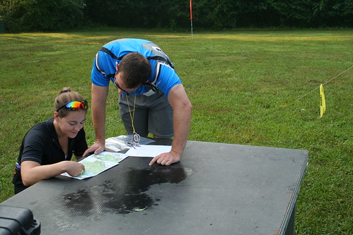
Imagine biking through the woods to find a checkpoint marked on your topographic map.  Your partner is using the compass to find West while you’re busy scouting the terrain for the creek marked on the map.  100 yards ahead you spot it, a small white and orange kite propped against a tree.

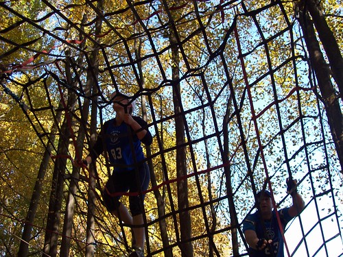
rope net

Adventure racing can best be described as a competitive scavenger hunt for adults. Split into multiple disciplines, the race involves locating checkpoints marked out on the course.  You may be required to obtain some of the check points on bike, others on foot, still other by boat or better yet rappelling.  There may be certain challenges you have to complete along the way, possibly logic games, an obstacle course or even a rock wall or fireman’s carry.   Your equipment generally includes a compass, food and water.  Beyond that it’s your own wit and skill to guide you to the checkpoints.   And it’s fun.  Ridiculous, I haven’t had so much fun since I was 12 riding my bike to the lake fun.

IMG_3598_jpg

Adventure racing as a sport is growing at an incredible rate.  More cyclists, triathletes and runners enter the sport each year, looking for a new challenge. Adventure racing takes skill and endurance.  The short sprint distance races may range anywhere from 4-6 hours while longer races may last many days and cover expansive territory.  Adventure racing camps will teach you the basic skills if you’re looking to do a longer race, but for those of us who are more of the “weekend warrior” type, here’s what you need to know.  We’ll cover choosing gear in an upcoming post.

IMG_0318

The Teams

Teams are usually 2-4 people depending on the company that is putting on the adventure race.  They’ll likely have several divisions, mens, coed and possibly womens.  Choose your partner(s) wisely, you’ll want people that not only have skills to supplement your weaknesses, but also people you can work with and trust.  Nothing takes the fun out of something faster than having the wrong teammates.

The Events

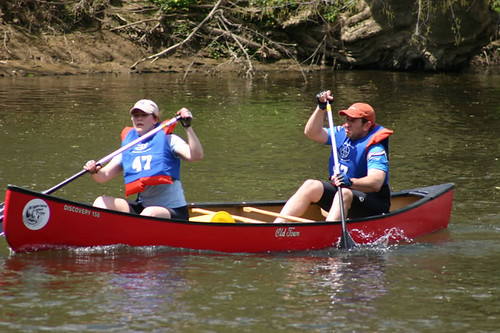
You can almost guarantee that every adventure race is going to at least have an orienteering and mountain bike component.  Orienteering is the on-foot section of the course (here’s where you get to run around the woods with a map and compass).  Generally you should be prepared to cross terrain without a path, with only your compass and topographic map to guide you.  The mountain bike section will likely be limited to trails, but we’ve been at some races where we’ve had to hike our bikes up and over the hill, so read your map carefully.  Frequently there is also a paddling section, usually canoeing or kayaking.  This section usually isn’t that technical, but it will save you a lot of aggravation on the water if you paddle a few times with your teammates before the actual event.

IMG_2880

The Skills

  1. Orienteering. You should be comfortable using a compass before the event and comfortable reading a topographic map.  Neither is difficult to use, but you’d be surprised how many people have difficulty with a compass once they’re lost.    Make sure everyone on your team understands how to use a topographic map and understands the legend.
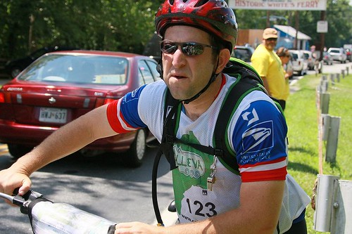
  2. Mountain Biking. You should be comfortable riding a mountain bike and have the endurance to complete the biking portion.  Sprint races will often give you an estimate on the distance for the mountain bike section- make sure you can complete it.
  3. Endurance. This is probably the most important skill you need to have. And yes, endurance is a skill – you have to understand how to pace yourself and how to maintain your energy levels.  Even a four hour race requires pacing and endurance, so if you’ve never completed endurance event before, think about what you’ve used in the past to get you through a long run or ride.

We’ll get more into the endurance and gear aspects of Adventure Racing in the next few weeks. Check out the US Adventure Racing Association for more information on the sport and check out events in your area!

Filed Under: Headline, Hike, Running, Trek Tagged With: athletics, endurance, sports

Vienna: Care to waltz?

July 5, 2010 By Jillian

Vienna is probably best known for its high culture: theater, opera, classical music, dance and museums. The center of the Austro-Hungarian empire for hundreds of years, we weren’t actually interested in seeing the cultural side of Vienna. Perhaps we’ve been in the “bush” too long, but I couldn’t really picture going to the opera in my chaco’s and convertible safari pants. Maybe that’s just me.Lucky for us there is a lot more to Vienna than it’s high culture.

Vienna is called a “green” city, and when you look at the map it’s not hard to figure out why. Our first day in Vienna we took a hiking trail, accessible by public transportation, which wound through mountains and into vineyards. Seriously. No more than an hour after leaving the city we were in the middle of the woods atop a mountain overlooking Vienna. Climbing Kahlenberg-Leopoldsburg wasn’t a technical hike, the steep trail was paved most of the way, but the views were spectacular and we had to remind ourselves we were in one the largest cities in Europe. We picnicked in a vineyard and watched deer steal a few grapes for themselves.

Not satisfied with a hike through the vineyards, we convinced our couchsurfing host to come to hike in the “viennese alps” with us. Hiking through alpine meadows up Schneeberg (snowmountain) was the highlight of our trip to Vienna. Especially when we saw the snow at the top. Let’s just say our African wardrobe was rather inadequate. Fortunately the alps are dotted with rest huts, which serve beer, schnapps, and even food.

We did get in a little musical culture while in Vienna. The Danube Island Festival, a huge annual 3 day concert with over 2000 artists, the Viennese really know how to throw a festival. It’s the largest outdoor festival in Europe. Crowds of people, from teenage punks to toddlers and grandparents roamed the island moving from stage to stage listening, dancing and rocking-out to the music. On one of the stages, we caught a German 1950’s rock and roll cover band, complete with hair gel and combs. Like Elvis the front guy doo-wopped across the stage, while his bassist and guitarist performed acrobatics with their instruments. It was like back to the future when Marty rocks the under the sea dance. Not exactly Mozart.

Filed Under: Austria, Europe, Headline, Hike Tagged With: cities, festival, hiking, music

  • 1
  • 2
  • 3
  • Next Page »

Connect With Us

  • Email
  • Facebook
  • Flickr
  • Pinterest
  • RSS
  • Twitter

Featured Posts

Our Bucket List
How We Travel For Free
$ Travel Tips

Recent Comments

  • Barbara on Kayaking Kauai’s Na Pali Coast
  • Lori Hubbard on Review: Eneloop Batteries and Charger
  • TK on The Trouble with Philadelphia

Banking on the Road

It can be very hard to keep track of your finances while you're on the road long-term. Be sure to check out how we took care of our finances while traveling and feel free to email us any questions you have.

Adventure Guides

Torres Del Paine
China Adventure
Uzbekistan Overland
Egyptian Odyssey
Malaria
Argentina Adventure
DIY African Safari
South Africa Guide
Bolivia by Bus
How-To African Visas

[footer_backtotop]

Copyright 2008-2015 · All Rights Reserved · Contact I Should Log Off · RSS · Partner With Us · Privacy